Mapping and Direction in Geography
These pictures show our terrific learning in mapping and direction. Our children start by using simple maps and globes to understand their purpose. They move to become more proficient at using the features of maps to identify what the land is like, directions and describing locations. Eventually they are able to interpret maps with unusual projections or to identify trade routes for example.
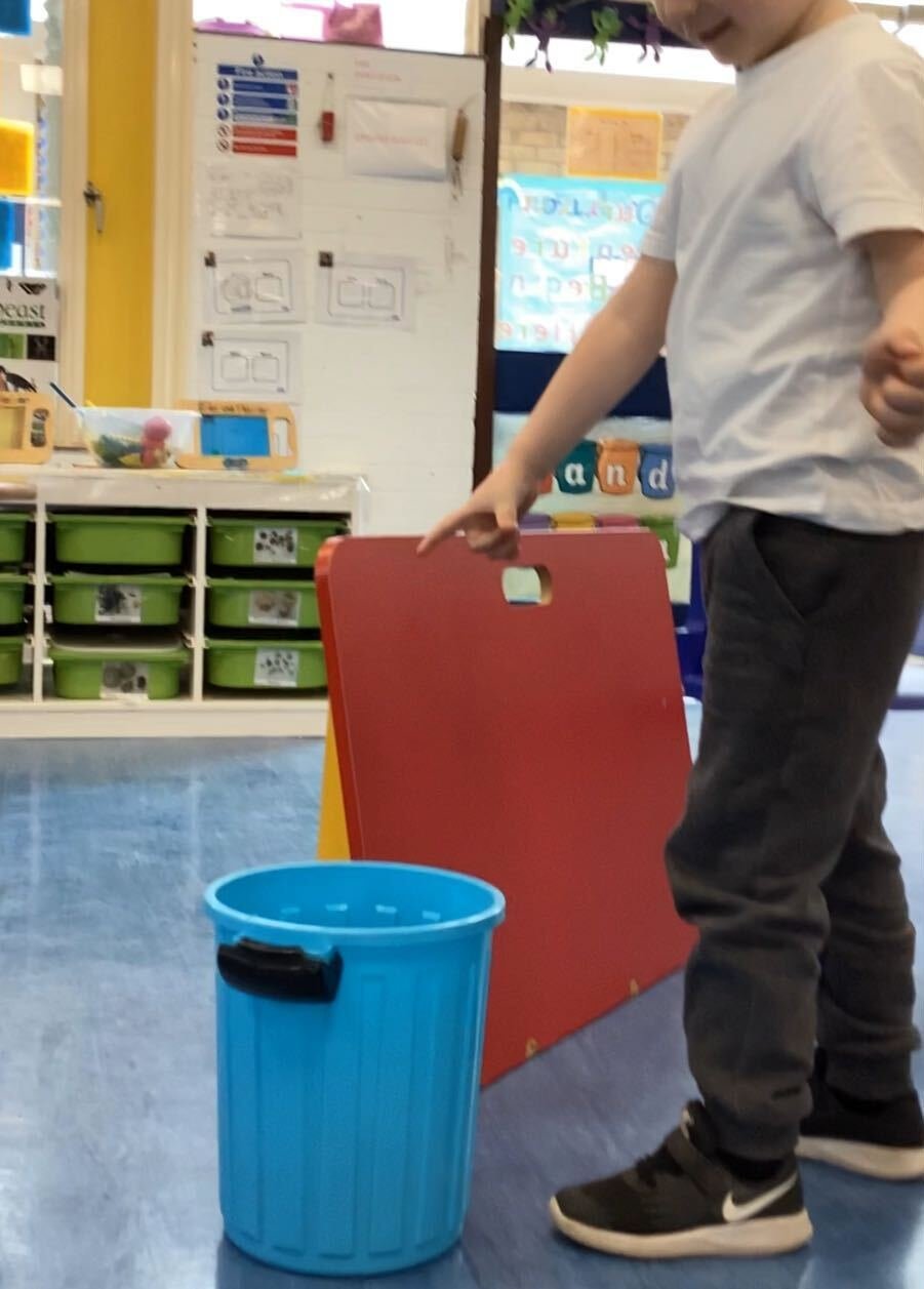
We’re Going on a Bear Hunt in Nursery
Children used positional language such as ‘in the bucket’, ‘behind the board’, ‘under/on the chair’, to place a bear in different places on an obstacle course and to describe where he was.
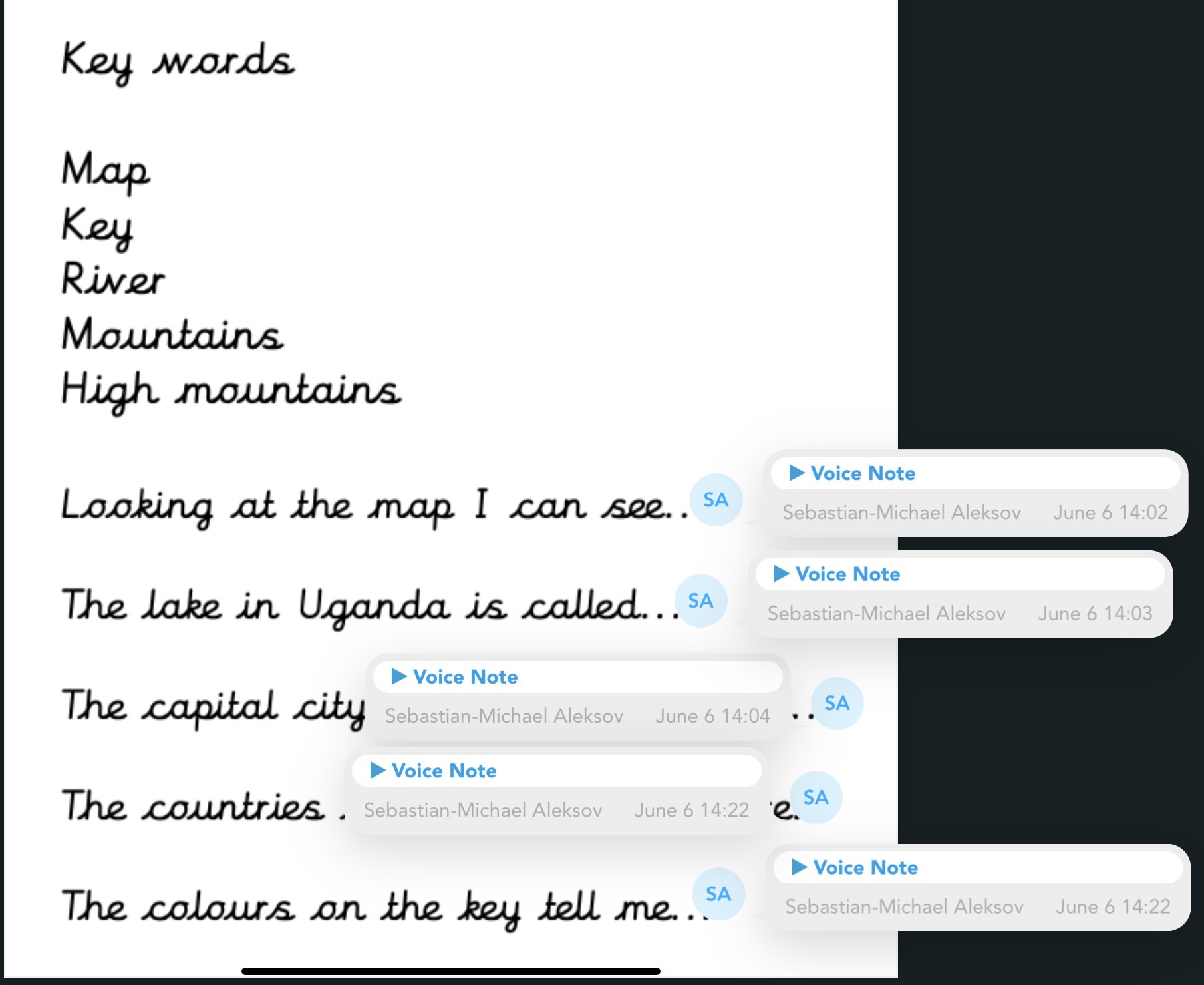
Learning about Uganda in Year 2
In our topic, we developed our mapping skills by used the features of an atlas such as the contents page and index to find Uganda on different scale maps to develop our understanding of where it is in the world. We used the key to identify features such as rivers, lakes, cities, national parks and mountains. We used voice notes on Showbie to record what we had discovered.
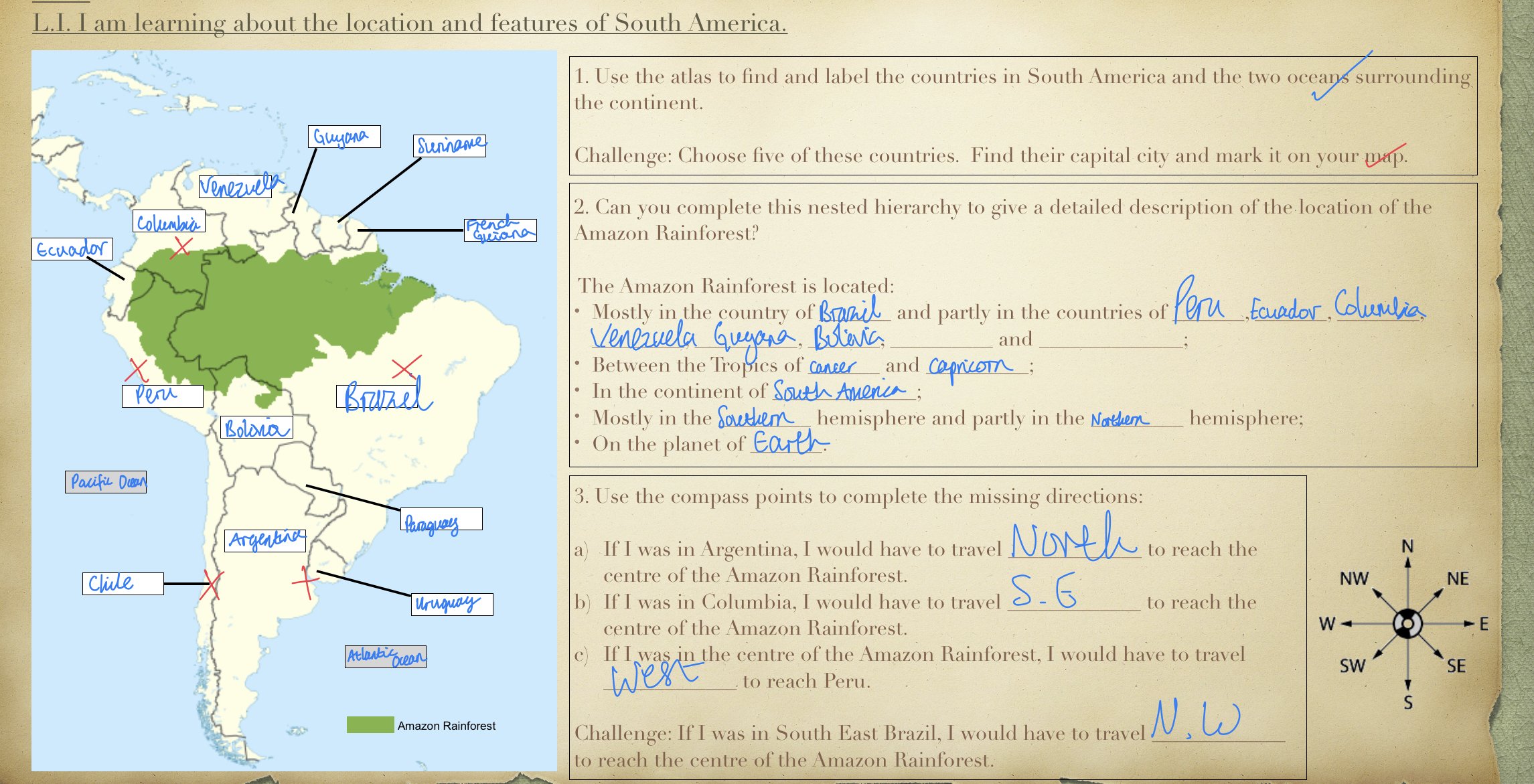
The Amazing Amazon in Year 4
We used the features of atlases to identify where the Amazon Rainforest is in terms of continents, the equator and the tropics of Cancer and Capricorn and the countries it lies in. We described it’s location in terms of a nested hierarchy. We described how to reach this place from different locations on the maps using the 8 points of the compass.

Life on the Edge in Year 6
We have focussed on using Ordnance Survey maps (OS maps), which show topographical features and compared them with Google Earth maps to locate and extract information about a range of mountains. We have then used contour lines to identify a route to reach the summit which would be the least strenuous.